

by Jane Bradley
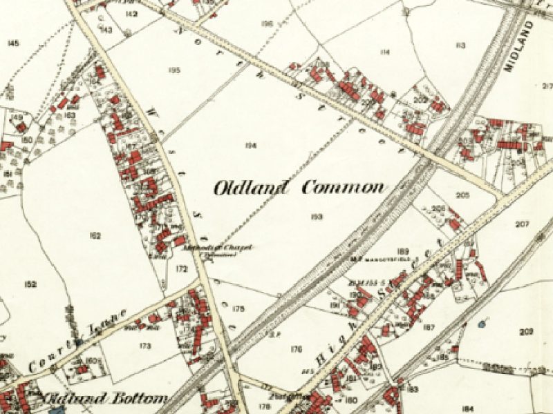
Oldland Common originally comprised a triangular plot bounded by West Street, North Street, and High Street. These lands, once traditional medieval commons, were gradually enclosed by a series of parliamentary acts, culminating in the Inclosure Act of 1819 and a detailed award and map in 1827. By this time, ten fields had been established on the common—eight arable, one pasture, and one garden—mostly owned privately, with a few rented out.
In 1843, housing existed around but not on the common. Clusters of cottages were visible along surrounding roads, while the common itself remained divided into fields. This changed after the Midland Railway Act of 1864, which cut through the southern portion of the common. The railway opened in 1869, but Oldland Station was only added in 1935.
By 1882, building began to encroach on the common, especially along the High Street and around the railway. Two footpaths also existed: “The Piece,” which still remains as a path, and another, now vanished, that once crossed Oldland Girls School playing fields and was officially closed in 1965.
By the early 1900s, housing development expanded further, with the addition of factories and terraced housing. Property transactions increased, and the land was subdivided into smaller plots. One proposed plan to build twenty-four homes on new roads named King Street and Queen Street was never realized, possibly due to financial or practical constraints. Instead, land was sold off piecemeal, resulting in individually built houses with large gardens—many retaining the original orchard trees, some of which survive today.
Frederick Gerrish’s (my great grandfather’s) plot was used for both his family home and bootmaking business, with an orchard and workshop behind the house. His purchase of additional plots in 1931 further expanded the family’s landholdings. By this time, much of the common had been parcelled out for housing or remained as gardens and orchards.
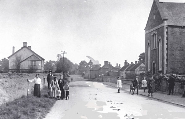
Community infrastructure also grew during this period. Before World War I, the Oldland Village Club was established in West Street. Between the wars, more plots along West Street were developed. In the post-war years, local councils began investing in housing, with homes built for the district nurse and elderly residents, as well as a police station.
Education significantly influenced land use on the common. The 1944 Education Act (effective in 1947) led to the creation of separate primary and secondary schools. Oldland Common Secondary School for Girls opened in 1956 on North Street to accommodate the growing post-war population. As space was limited, Gloucestershire Council had even resorted to hiring chapel halls as makeshift classrooms. The boys’ and girls’ schools eventually merged in 1971, officially opening as one in 1972 after expansion. The school has since grown to occupy most of the remaining common land.
The latest wave of development has occurred south of the railway, repurposing former industrial sites into residential areas. These include Gooch Court, Edgemont View Nursing Home, Trescothick Close, and North Croft—all representing the ongoing transformation of Oldland Common from farm land to suburban landscape.
Jane Bradley, 2025
To learn more about our local history, visit: www.bittonhistory.org.uk